Offshore Temperature Breaks: How SST Charts Help You Find Mahi, Wahoo & Billfish
Two summers ago I ran a trip 40 miles offshore out of Clearwater. We had live baits, fresh-rigged pitch baits, the cooler packed — everything right. Spent the first three hours riding around in flat, featureless blue water and caught exactly nothing. Meanwhile, a boat I recognized on the radio was getting lit up about 12 miles north of us.
The difference? They were on a temperature break. We weren't.
When I got back to the dock and pulled up the SST data, it was obvious. There was a sharp color gradient on the chart — a clear edge where 80°F water met 86°F water — and that's exactly where those fish were stacked. I'd been fishing the right species, the right techniques, the right baits. I just wasn't in the right water.
That's the thing about offshore fishing. You can do everything else correctly and still get blanked if you're not reading the water temperature picture. This article breaks down what sea surface temperature breaks actually are, how to read SST charts, and how to use them to put more mahi, wahoo, and billfish in the boat this summer.
What Is a Sea Surface Temperature Break — and Why Do Fish Care?
A sea surface temperature (SST) break is exactly what it sounds like: a boundary zone where two bodies of water with different temperatures meet. From the air — or on a satellite chart — it shows up as a color gradient. On the water, you might see a color change, a rip line, floating debris, or a weed edge.
But fish don't care about color changes for aesthetic reasons. They care because temperature breaks are almost always productivity zones.
The Science Behind the Edge
When two water masses collide, you get upwelling, convergence, and nutrient mixing. Cooler, deeper water often carries dissolved nutrients toward the surface. That feeds phytoplankton, which feeds zooplankton, which feeds baitfish — and everything above baitfish in the food chain follows.
NOAA Fisheries has documented this relationship extensively. Pelagic species like mahi-mahi, wahoo, and billfish are highly mobile predators that will travel significant distances to find concentrated forage. The temperature break acts like a dinner table — the food piles up there, and the fish follow.
Beyond the baitfish concentration, there's also a comfort zone element. Many pelagic species have preferred temperature ranges. A break gives them the option to hold on the edge and feed in both water masses depending on conditions. Think of it as the fish's version of sitting near the air conditioning vent in August.
Temperature Ranges That Matter
Based on years of offshore work in the Gulf and Atlantic, here's a rough guide to what you're looking for by species:
| Species | Preferred Water Temp | Notes |
|---|---|---|
| Mahi-mahi | 75°F – 85°F | Love warm blue water, weed lines |
| Wahoo | 72°F – 82°F | Often just below the surface thermocline |
| Sailfish | 74°F – 82°F | Highly temp-sensitive |
| Blue Marlin | 78°F – 88°F | Prefer the warmest blue water available |
| Yellowfin Tuna | 64°F – 78°F | Cooler end of the range |
These aren't hard cutoffs — fish don't read charts. But in my experience, when water temps fall outside these ranges by more than a few degrees, the bite gets significantly harder to produce.
How to Read an SST Chart
SST charts pull data from satellite imagery and display sea surface temperature across a geographic area using a color scale. Most use a gradient from blue/purple (cooler) to red/orange/yellow (warmer).
The key is not just looking at the colors — it's finding where the colors change fast.
Color Gradients vs. Flat Water
A tight gradient — where multiple color bands compress into a short horizontal distance on the chart — indicates a sharp temperature break. That's prime real estate. Fish, baitfish, and floating structure like weed mats tend to concentrate right along those edges.
A flat, uniform color across a wide area typically means temperature-stratified water with little vertical mixing. You might find scattered fish, but there's no particular reason for them to stack up.
Pro tip: Don't just look at where the warm water is. Look for where warm and cool water are pushing against each other. That friction zone is where the action happens.
Reading a Weed Line on the Chart
In the Gulf of Mexico and Atlantic, Sargassum weed lines are often associated with temperature breaks. The weed gets pushed to the edge where converging currents meet — the same place fish concentrate. On an SST chart, look for a color boundary running roughly parallel to the coastline at your target depth. Then cross-reference with aerial imagery or current charts from NOAA's ocean services portal to estimate where weed might be concentrating.
What Resolution to Look For
Not all SST charts are created equal. Some use 1-km resolution data, others are much coarser. For offshore fishing purposes, you want:
- Daily composites rather than multi-day averages (breaks move)
- 1-km or better resolution when cloud cover allows
- Recent data — ideally from the last 24–48 hours
Cloud cover is the main limitation with satellite-derived SST. A heavy overcast can blank out your data for days. In those cases, use the most recent clear-sky composite and factor in current drift direction. Breaks don't disappear overnight, but they do move.
Summer Offshore Strategies by Species
Summer is prime time along the Gulf Coast and South Atlantic. Water temps in the 82°F–88°F range are common in offshore Florida waters by July, and the Gulf Stream along the Atlantic side pushes warm blue water tight to the shelf. Here's how to use SST data to target the three main species anglers are after this time of year.
Mahi-Mahi: Follow the Color Change and the Grass
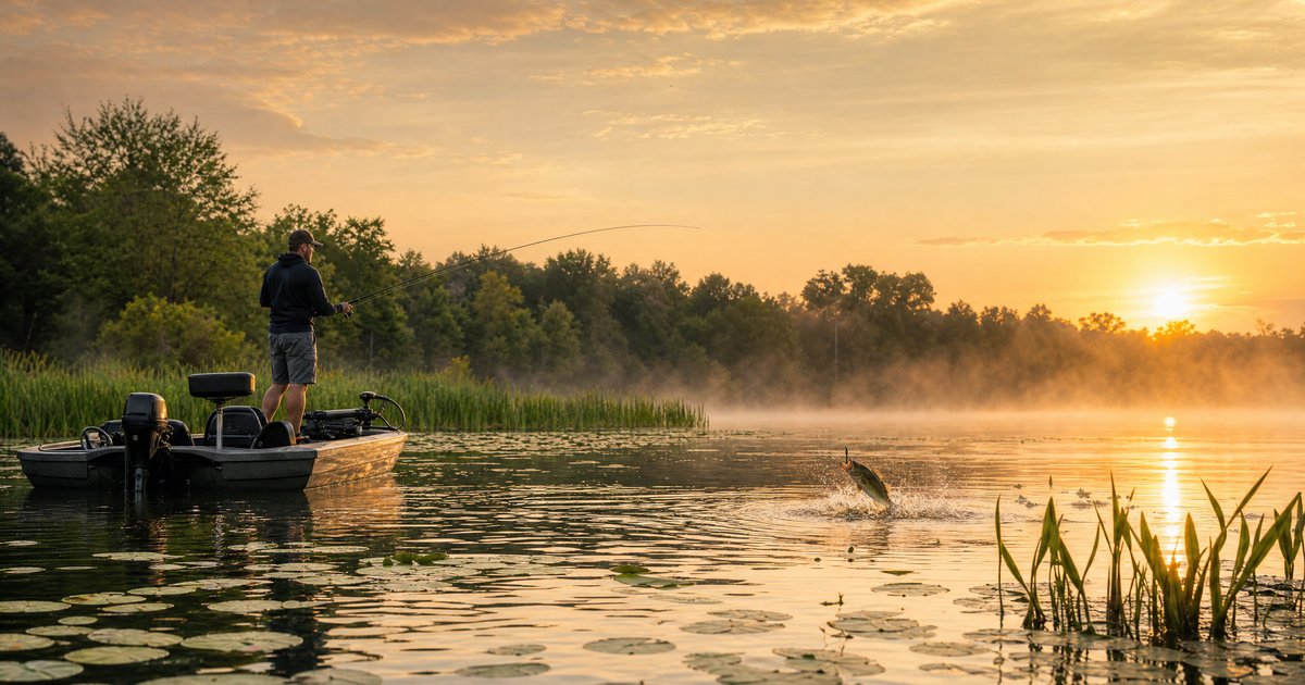
Mahi are arguably the best fish for anglers just getting into offshore temperature break fishing because they're visually tied to structure — weed lines, floating debris, current rips — that often corresponds directly to the temperature break.
On your SST chart, look for the 83°F–86°F blue water and find the closest hard edge to it. Then run to that edge and look for floating grass, birds, or rip lines on the water's surface. Mahi will be staging right on or just inside the warmer side of the break.
Trolling a spread of skirted ballyhoo along the weed edge on the warm side is hard to beat. If you spot free-swimmers or jump a school, live pilchards or goggle-eyes pitch-fished back into the school will out-produce everything. Keep the boat on the edge — don't drive through the fish.
One thing I've noticed in Gulf waters specifically: mahi tend to run shallower in the water column during summer. Early morning, they're often right in the top 10–20 feet. Mid-day heat pushes baitfish deeper, and the mahi follow. Adjust your trolling depths accordingly.
Wahoo: Targeting the Cooler Edge
Wahoo are different from mahi in that they often stage on the cooler side of the temperature break, or just beneath the surface layer at the thermocline. They're speed predators — faster than almost anything in the water — and they like the slightly cooler water to the inside of the break.
If your SST chart shows a break at, say, 82°F transitioning to 79°F, your wahoo are more likely to be in or near that 79°F water, not the 85°F water where the mahi are schooling.
For tactics, high-speed trolling — 12 to 18 knots with diving plugs or rigged ballyhoo on wire leader — is the standard approach. Wahoo have razor-sharp teeth, so wire or heavy fluoro is non-negotiable.
Field observation: In 15 years of offshore fishing in the Gulf, the best wahoo bites I've had have been on cloudy, slightly overcast mornings along the temperature break — not the bluebird postcard days. Whether that's coincidence or comfort-zone behavior, I can't say for certain, but I lean toward running wahoo gear when the sky looks like rain.
Billfish: Chasing the Warmest Blue Water
Sailfish and marlin are the glamour species, and they're also the most temperature-selective. Blue marlin in particular want the warmest, deepest blue water they can find — often following the Gulf Stream or other warm eddies that spin off the main current.
On summer SST charts along Florida's Gulf Coast and the Atlantic side, look for offshore eddies — circular warm water features that can hold temperatures 2–4°F warmer than surrounding water. These eddies are essentially concentrated hot spots that attract blue water species. They show up on SST charts as oval or circular warm patches spinning off the main current.
Sea Grant's coastal research resources offer useful background on how Gulf eddies form and persist — worth reading if you're running far offshore and need to understand the bigger picture.
For sailfish, live baiting with kite fishing remains the gold standard in Florida waters. For blue marlin, a spread of large skirted lures in the trolling pattern, with one or two pitch baits ready to go, is how most captains operate. Neither technique is cheap on fuel or tackle, which is all the more reason to use SST data to reduce the guesswork and stay in productive water.
Tools and Timing: How to Actually Access Good SST Data
Knowing what to look for doesn't help if you're using bad data or checking it at the wrong time.
Free and Paid SST Resources
There are solid free options. NOAA's CoastWatch program publishes near-real-time SST composites for U.S. coastal waters, and apps like Navionics layer SST data over chart plotting. For dedicated offshore fishing, services like Hilton's Realtime Navigator or SiriusXM Marine offer higher-resolution, more frequently updated data for a subscription cost.
Before any offshore trip, I pull an SST chart alongside weather and sea state data. Check the offshore weather outlook on HookCast to layer your sea state picture on top of the temperature break location — because knowing where the break is doesn't matter if 8-foot seas make it unreachable.
When to Pull the Data
Check your SST chart the night before your trip and again the morning of if you have updated data. Temperature breaks move, especially after storm systems or strong wind events. A 20-knot northerly for two days can push the break 15–20 miles (based on field observation, not a fixed formula — your mileage will vary depending on local conditions).
If you're running more than 30 miles offshore, the break has likely moved enough since yesterday to matter. Build in flexibility in your trolling plan and don't commit to a hard waypoint based on 48-hour-old data.
Combining SST with Current Charts
Temperature breaks and current edges often coincide, but not always. For the most complete picture, overlay your SST data with surface current charts. Where a current edge and a temperature break align, you have the highest-probability zone on the water. That's the spot you drive to first.
Safety and Regulations for Offshore Trips
This section isn't optional.
Offshore fishing is inherently higher-risk than inshore work. Weather changes faster than you expect. Equipment failures 40+ miles from shore are serious situations. Before any offshore run:
- File a float plan with someone onshore
- Carry an EPIRB, flares, and a functioning VHF
- Check weather not just for departure but for the window when you'll be returning — afternoon thunderstorms in summer are common along Florida's Gulf Coast
- Know your boat's offshore limits and don't push them for "one more hour" of fishing
On the regulatory side: mahi, wahoo, and billfish are federally managed species in U.S. waters. Size and bag limits apply, and sailfish and marlin are billfish that require a federal Atlantic Highly Migratory Species (HMS) permit to target. Check current regulations with NOAA Fisheries Highly Migratory Species before you leave the dock. Regulations change, and "I didn't know" doesn't hold up on the water with federal fisheries officers.
For billfish specifically — and mahi when you've limited out — proper catch-and-release technique matters. Keep the fish in the water when possible, remove the hook quickly, and support the fish upright until it swims off under its own power. These are long-lived, wide-ranging species that support fisheries across the entire Atlantic and Gulf basin.
Quick-Reference: Using SST Charts for Offshore Fishing
Before your trip:
- Pull an SST chart within 24 hours of departure
- Identify the sharpest color gradient (tightest temperature transition)
- Note the temperature range on both sides of the break
- Layer with surface current data for highest-probability zones
- Check sea state and weather on HookCast's offshore weather tool
On the water:
- Look for visual confirmation: color changes, weed lines, rip lines, birds
- Mahi → fish the warm side of the break, near floating structure
- Wahoo → troll the cooler side of the break at high speed on wire
- Billfish → target warm eddies and the warmest available blue water
Temperature targets:
- Mahi: 75–85°F
- Wahoo: 72–82°F
- Sailfish: 74–82°F
- Blue Marlin: 78–88°F
If the bite is off:
- Check if the break has shifted since your chart was pulled
- Try the opposite side of the temperature edge
- Look for secondary breaks inside or outside your primary target area
- Don't discount depth — summer fish can go deep when surface temps get extreme
Reading water is a skill that takes time to develop, and SST charts are one piece of the puzzle — not the whole picture. But used consistently, they'll cut down the dead water runs and put you on productive fish more often than gut instinct alone. The boat that gets lit up while you're scratching your head isn't always luckier — sometimes they just did their homework.
FAQ
What is a sea surface temperature break in fishing?
A sea surface temperature (SST) break is a boundary zone where two water masses of different temperatures meet offshore. These edges create upwelling and nutrient mixing that concentrates baitfish, which in turn attracts pelagic species like mahi-mahi, wahoo, and billfish. On SST charts, breaks appear as tight color gradients where the temperature shifts significantly over a short distance.
What water temperature is best for mahi-mahi offshore?
Mahi-mahi are most commonly found in sea surface temperatures between 75°F and 85°F, with peak activity typically in the 80°F–86°F range during summer months. They favor warm blue water and are frequently found along weed lines and floating debris that collects on temperature break edges. When water temps drop below 72°F, mahi tend to move offshore or into different water masses.
How do I read an SST chart for fishing?
On an SST chart, colors represent water temperatures — typically blue/purple for cooler water and red/orange/yellow for warmer water. The key for fishing is finding where these colors transition sharply, which indicates a temperature break. Tight color gradients over a short geographic distance represent the most productive edges for pelagic species. Free SST data is available through NOAA's CoastWatch program, and paid options offer higher resolution for serious offshore planning.
Do wahoo and mahi prefer the same water temperatures offshore?
Not exactly. Mahi-mahi tend to stage on the warm side of a temperature break, typically in 80–86°F water near floating structure. Wahoo often prefer slightly cooler water — generally in the 72–82°F range — and frequently hold on the cooler side of the temperature break or just below the surface thermocline. When fishing a temperature edge, it's worth trolling both sides to determine where each species is staging that day.
How often do offshore temperature breaks move?
Temperature breaks can shift significantly — sometimes 10–20 miles — following strong wind events, storm systems, or changes in current flow. For offshore trips beyond 30 miles, it's worth pulling fresh SST data within 24 hours of your departure rather than relying on charts from the previous day or two. Breaks don't disappear quickly, but their position can change enough to matter when you're planning a long run to a specific waypoint.